FBCLID 7 Brazos River Erosion Control Project Reaches 30% Design
Posted: May 21, 2020 | 3 min read
The Fort Bend County Levee Improvement District No. 7 (FBCLID 7) levee protects New Territory along its southern boundary with the Brazos River. Historically at this location, up until 2014, the north shore of the Brazos River experienced moderate bank erosion as is expected for a meandering waterway.
Unfortunately, between 2015 and 2017, the northern riverbank experienced a dramatic increase in the rate of erosion due to multiple, historic-level flood events, including Hurricane Harvey. This increase resulted in the riverbank migrating closer to the levee system, threatening its structural integrity and increasing the flood risk to the residents of New Territory and their homes.
The Brazos River Erosion Control Project (BRECP) aims to proactively manage the risk using two techniques:
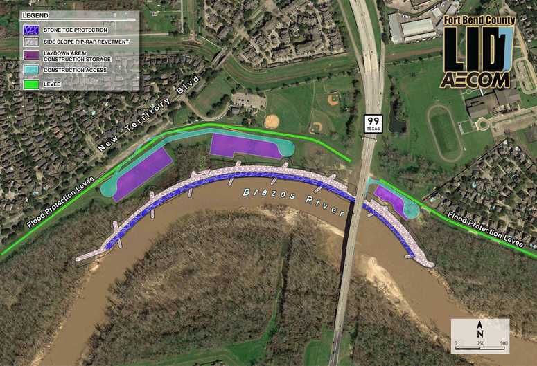
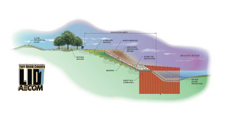
The first is to stabilize the riverbank by applying Launching Stone Toe Protection (LSTP) at the water line of the river, and stone riprap along the slope to stabilize the bank. The LSTP is engineered to provide protection similar to the regular riprap along the slope but is placed in such a fashion to facilitate, should the water continue to scour the river bottom and erode the soil below the water surface, rock boulders sliding inside the channel and filling voids as they are forming before issues can develop.
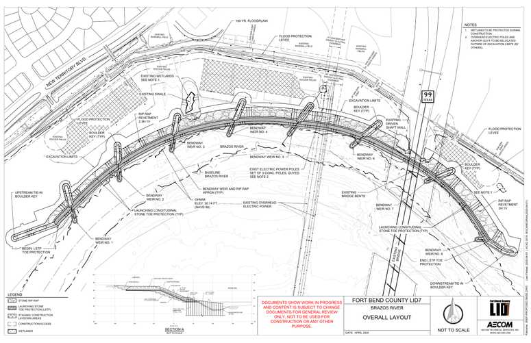
The second technique is to install a series of bendway weirs designed to “train” the river flow and gradually restore the river centerline back toward its previous location, prior to the increased bank erosion, and promote improved hydraulic conditions.
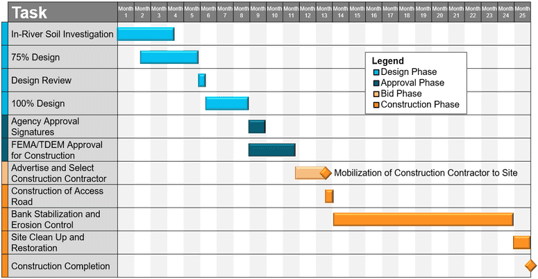
The figures below show the extent of the protection measures along with renderings of what they final solution could look like, along with supporting design installation features. Modeling of the existing and proposed conditions has been performed and careful consideration has been given to find an optimal solution that reduces the risk to the levee and to prevent adverse impacts to neighbors and communities upstream and downstream of the project location.


.jpg)

For more information on this or other projects the FBCLID 7 has approved to mitigate flood risk, please reach out to the District through the “Contact Us” page on the website.
Have your neighbors been interested in the FBCLID 7 projects and their status? Share this out to social media! Click the links at the top of the article to share directly to Facebook or Twitter, or copy the link for sharing to Nextdoor.